LONG RANGE SCANNING
3D Scanning Services
3D SCANNING SERVICES
LONG RANGE SCANNING
Data Collection from a Distance
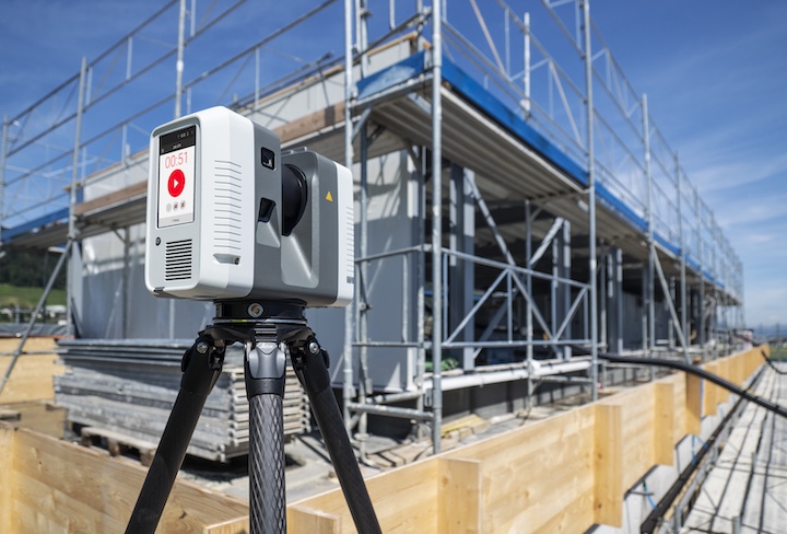
Long Range Scanning allows our team to take detailed 360º as-built data captures of any large-scale structure, bridge, plot of land, industrial plant, or process operation with millimeter accuracy— allowing scans of dangerous or hard-to-reach environments to be executed safely and effectively.
After collecting highly accurate data sets, we can take your 3D information to the next level.
Examples of advanced deliverables include:
The Value of Long Range Scanning & As-Built Modeling for Every Application
Exact Metrology offers long range scanning services to create as-built digital models – highly accurate 3D representations of over 328 feet of assets that reflect their current, real-world condition. By providing a true-to-life record of a physical asset, digital models ensure improved efficiency, reduce costly rework, and enhance long-term asset management. These models are essential for industries that require detailed documentation for maintenance, compliance, retrofitting, and long-term asset tracking.
Aerospace & Defense
As-built models are critical for both new builds and maintenance of aircraft, naval ships, and submarines— extending active duty time.
Oil, Gas & Energy
Offers precise documentation that supports efficient maintenance, streamlined upgrades, and risk mitigation for critical infrastructure while maintaining safety.
Manufacturing
Investing in as-built digital models gives manufacturers an up-to-date view of assets, enabling accurate planning, seamless upgrades, and reduced errors.
Clean Energy
Guarantees precise installation and maintenance, while supplying accurate data to assess the structural integrity of assets such as wind turbines and dams.
Power Generation
Essential systems like boilers, cooling systems, fuel handling, piping, and safety infrastructure benefit from precise installation and optimized maintenance.
The Value of Long Range Scanning & As-Built Modeling for Every Application
Exact Metrology offers long range scanning services to create as-built digital models – highly accurate 3D representations of over 328 feet of assets that reflect their current, real-world condition. By providing a true-to-life record of a physical asset, digital models ensure improved efficiency, reduce costly rework, and enhance long-term asset management. These models are essential for industries that require detailed documentation for maintenance, compliance, retrofitting, and long-term asset tracking.
Aerospace & Defense
As-built models are critical for both new builds and maintenance of aircraft, naval ships, and submarines— extending active duty time.
Oil, Gas & Energy
Offers precise documentation that supports efficient maintenance, streamlined upgrades, and risk mitigation for critical infrastructure while maintaining safety.
Manufacturing
Investing in as-built digital models gives manufacturers an up-to-date view of assets, enabling accurate planning, seamless upgrades, and reduced errors.
Clean
Energy
Guarantees precise installation and maintenance, while supplying accurate data to assess the structural integrity of assets such as wind turbines and dams.
Power Generation
Essential systems like boilers, cooling systems, fuel handling, piping, and safety infrastructure benefit from precise installation and optimized maintenance.
After collecting highly accurate data sets, we can take your 3D information to the next level.
Examples of advanced deliverables include:


